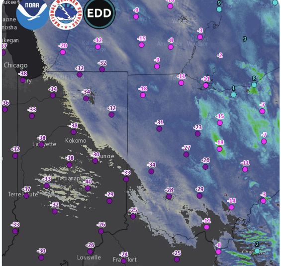
Satellite Photo with wind chills of Winter Storm Elliott– Courtesy of the National Weather Service
Article Presented By McDonald’s…
Southern and Central Ohioans awoke to temperatures of minus 8 Thursday morning after Winter Storm Elliott arrived overnight. As rain was falling in southern Ohio late Wednesday, temperatures were at 42 degrees. By 3am Thursday, the temperature was at zero and still falling, along with snow.
Most area counties are at Level 2 Snow Emergencies as of Thursday morning, which means “roadways are hazardous with blowing and drifting snow. Roads may also be very icy. Only those who feel it is necessary to drive should be out on the roads. Contact your employer to see if you should report to work. Motorists should use extreme caution.”
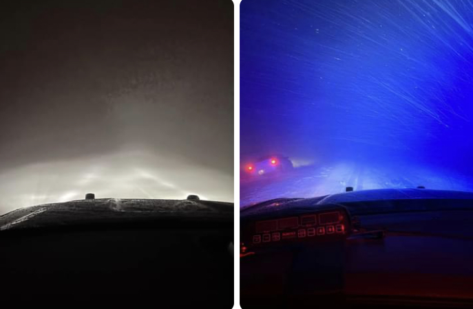
Whiteout conditions were seen in much of the area overnight, as the below dash cam photos from the Fayette County Sheriff show.
Snowfall amounts have ranged from 1-3 inches in southern Ohio and 2-4 in western counties and north of Ross County.
Temperatures are expected to rise to 12 degrees on Saturday, but winds of 20-30 miles per hour will still results in some sub-zero wind chills. Christmas Day calls for partly sunny and a high of 17.
Weather conditions vastly improve by midweek, with highs of 42 on Wednesday, then 50’s Thursday through Saturday and 60 on New Year’s Day.

More Stories
Red Cross Seeks Donors May Trauma Awareness Month
Ohio A.G. Seeks Input On Signature Protections
Recommendation Made to Raise Postal Rates