
Presented By Classic Brands
Schools, local government offices, services and many businesses closed as a winter storm entered the region Thursday.
Every school in Ross, Pickaway, Fayette, Pike, Highland, Fairfield had closed for the day, while Jackson County schools started in session Thursday, but are dismissed early.
All area sports activities for Thursday cancelled.
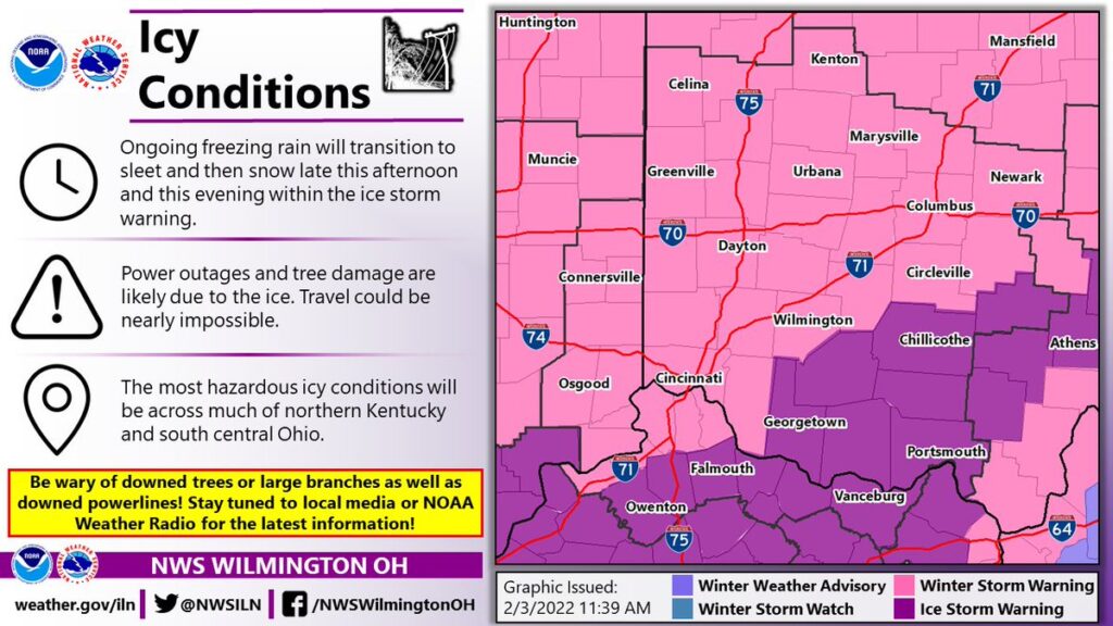
The National Weather Service added an Ice Storm Warning for the region at 11:23am, going through 7am Friday going along with the Winter Storm Warning for the entire state. Many of the TV meteorologists are saying they “can’t remember this happening in decades, possible as far back as the 1978 Blizzard.”
The Ice Storm Warning covered a line with Ross, Fairfield and Highland Counties to the north, going south to the Ohio River and into Kentucky.
Most area counties went to snow emergency status, including Level 3 for Ross, Pike, Fayette, Pickaway, Highland, Jackson, Hocking and Fairfield counties.
WINTER WEATHER ADVISORY IN EFFECT UNTIL 10am FRIDAY MORNING. ICE STORM WARNING IS CANCELLED. Light snow continuing. Additional snow accumulations of up to one inch. Portions of Central, South Central and Southwest Ohio and Northeast and Northern Kentucky.
Friday A chance of snow, mainly before noon. Cloudy, with a high near 21. North wind 9 to 14 mph. Chance of precipitation is 50%. New snow accumulation of less than a half inch possible.
Friday Night Mostly cloudy, with a low around 0. Wind chill values as low as -12. West wind 3 to 6 mph.
Saturday Mostly sunny, with a high near 21. Northwest wind around 5 mph becoming calm in the morning.
Saturday Night Mostly clear, with a low around 6.
Sunday Sunny, with a high near 34.
Sunday Night Partly cloudy, with a low around 13.
More Stories
Appalachia Grant Monies: Oh, Happy Day!
DeWine Announces Transformative $154 Million Investment in Appalachian Downtowns and Destinations
Heritage Nazarene To Host Tragedy Into Triumph Series